This is an advanced task for AUV Workbench developers. Discussion of details is welcome on the mailing list. The NPS team will help ensure that this integration proceeds correctly.
If usable GIS data for your location is already available, you are all done with this step.
AuvWorkbench/configuration/templates/c_geo.xml.
Example:
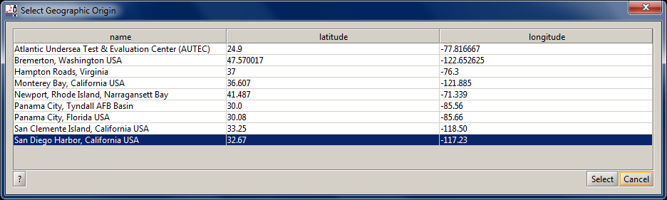
                        <geolocation units="decimalDegrees">


                           <!-- make sure to escape commas in these handles -->


                           <handle>Hampton Roads\, Virginia</handle>


                           <latitude>37</latitude>


                           <longitude>-76.3</longitude>


                           <scale>1600000</scale>


                           <X3Dscene type="path">${SavageRoot}Savage/AuvWorkbench/OperatingAreas/HamptonRoadsOpArea.x3d</X3Dscene>


                        </geolocation>
AuvWorkbench/configuration/templates/
directory. The parent directory contains only a user's local copies.
configuration/templates/c_om_LocationName.xml
files, such as
AuvWorkbench/configuration/templates/c_om_monterey_tiger.xml
                        <openmap description="LocationName layer definition file for AUV workbench">


                           <layer prettyname="LocationName GIS information title" type="esrishape" visible="true">


                              <datapath>datasets/OpenMap/LocationName</datapath>


                              <props key="lineColor" value="80000000"/>


                              <props key="fillColor" value="80BDDE83"/>


                           </layer>


                        </openmap>
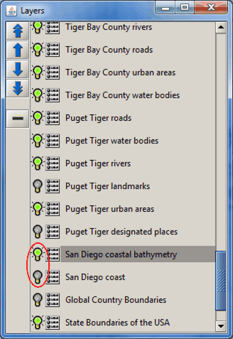
visible="true" for each layer, otherwise it is hidden by default.
To make a hidden layer visible,
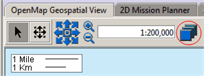
in the upper left-hand corner of the OpenGis tab and select the
OpenMap Layer Controls button.
Then select/deselect the
visibility buttons (light-bulb icons)
corresponding to layers of interest.
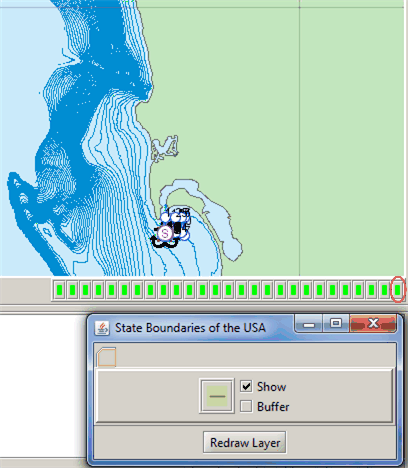
Once a layer is visible, you can also go to the lower right-hand corner of the OpenGis tab and use the small
green/red layer hide/unhide buttons.
Also note that hiding or making layers invisible can sometimes speed up redraw performance.
AuvWorkbench/configuration/templates/projectCommonsConfig.xml.
Example excerpt:
                        <additional>


                           <!-- c_om_layersroot.xml is mandatory -->


                           <xml fileName="c_om_layersroot.xml"/>


                           <!-- OpenMap dataset files defined in AUVW installation: -->


                           <xml fileName="c_om_LocationName.xml" at="gis">


                           <xml fileName="c_om_monterey_tiger.xml" at="gis">


                           <!-- ...additional layer files... -->


                        </additional>
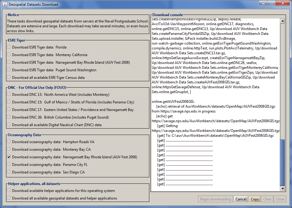
online.getLocationNameGIS
in Ant build file
build_downloads.xml.
To get this step right, copy and modify an existing task (such as
online.getMontereyBayCaliforniaGIS).
workbench.util.GeoUtils.java
(javadoc).
Back to the Help page index, the AUV Workbench: Introduction page, or online to AUV Workbench home page.